Dutch County Map of Cheshire by Janssonius, 1660s
A$3,003

You are now following Wall Decor. You can manage alerts in your account settings.
You have unfollowed Wall Decor.
Dutch County Map of Cheshire by Janssonius, 1660s
English Collegiate Map, Cambridge, 1838

Georgian County Map Rutlandshire by John Cary
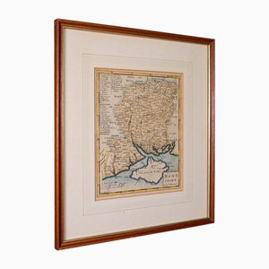
English Road Map Bristol to Weymouth

Antique English Georgian Framed Town Plan Map, 1780

Small English Country Map, Northamptonshire, 1850s

Coaching Road Map Cranborne to Dorchester

Large English Wimbledon Map SW London

Antique English Framed Cambridgeshire County Map by Robert Morden, Late 17th Century

Antique County Map by Robert Morden, 1700
Vintage Italian Fiat Service Advertising Sign, 1980s

Antique English County Map by Richard Blome, 1673

Vintage Italian Vespa Servicio Advertising Sign, 1980s

Vintage Italian BMW Advertising Sign, 1980s

Vintage Alfa Romeo Advertisement

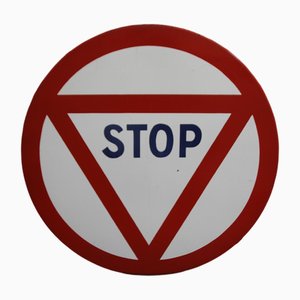
Red and White Enamel Metal Stop Traffic Sign, 1965
Large Antique Lithography Map of Northamptonshire by John Speed

St. Johns Wood Tube Station Roundel, 1940

Holborn Tube Station Roundel, 1950

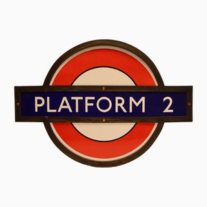
Early Underground Platform Roundel of London, 1950

Bank Tube Station Roundel, 1940

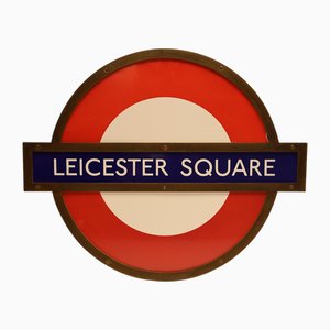
Leicester Square Tube Station Roundel, 1940
Early London Underground Platform Roundel, 1930
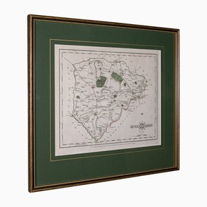
Antique County Map, Northamptonshire, English, Framed Cartography, Richard Blome

Vintage Linen School Map the Scots Pine

Antique Lithographic Map of Warwickshire

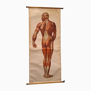
Vintage German Chart of the Human Body, Muscles, Germany, 1960
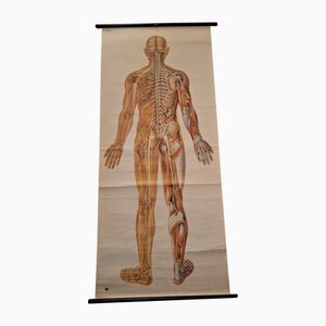
Anatomical Pull-Down Chart of the Human Body, Nervous System , Spine, Muscles & Tendons, Germany, 1960
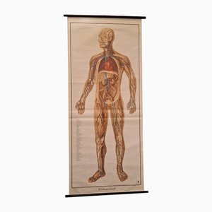
German Pull-Down Chart of the Human Body, Blood Circulation, Germany, 1960
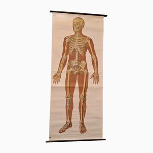
Anatomical Pull-Down Chart of the Human Body, Bones & Ligaments, Germany, 1960
American Coca Cola in Bottles Machine

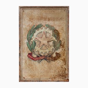
Italian Republic Iron Emblem, 1950s
Vintage Pull-Down Wall Chart, 1970
Large Sized Wall Chart, USA, 1980
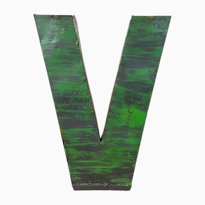
Large Vintage Green Iron Facade LetterV, 1970s
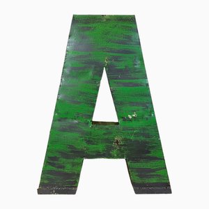
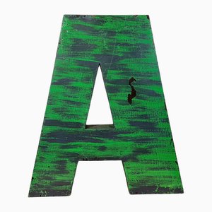
Large Vintage Green Iron Facade Letter A, 1970s
Lithography Map Hampshire, England, 1850s

Taiwan Map from Dutch East India Company, 1724

19th Century Pressed Brass Take Courage Pub Sign

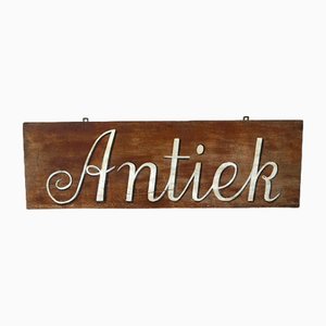
Advertising Sign Hand-Painted on Hardboard
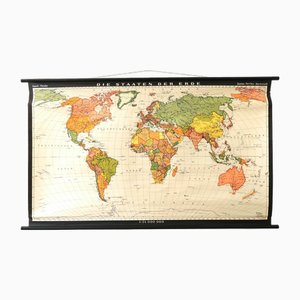
Vintage School/Teaching Card the States of the Earth by Haack-Painke for Justus Perthes Publisher, 1960s
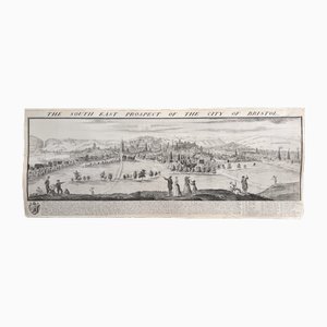
The South East Prospect of the City of Bristol by Samuel Buck, 1734
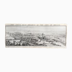
The North West Prospect of the City of Bristol by Samuel Buck, 1734
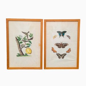
19th Century Butterflies and Birds Colored Framed Engravings, Set of 2
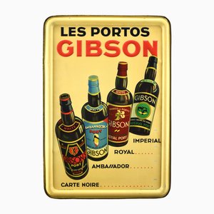
Tin Sign from Les Portos Gibson, 1936
Adac Deutscoer Automobil-Club Rounded Enamelled Metal Plaque

Printed Metal Plaque Transport Bus Stop from A.T.A.C.

Metal Enameled Plaque Never More Than a Liter of Wine Per Day from Academy of Medicine, France, 1950s

Hand Painted Bulls Head Inn Poole Pub Sign

Large Antique Lithography Map of Kent, 1700

Vintage School/Teaching Card Latin Source Script from Röhr Verlag, 1940s

Large Vintage Green Iron Facade Letter N, 1970s

Large Vintage Green Iron Facade Letter A, 1970s
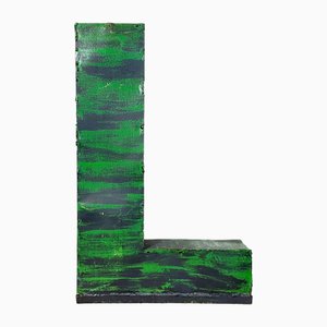
Large Vintage Green Iron Facade Letter L, 1970s
Lacquered Plaque the Blue Lotus Tintin by Hergé, 1950s

Gold Color Brass Bell

Three-Dimensional Illuminated Bar Sign in Orange Acrylic Glass and Aluminum, Italy, 1960s

Gold Color Brass Bell

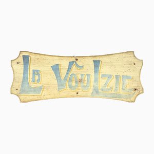
Wooden La Voulzie Sign
No. 5. Acrylic Glass Advertisement Display with Lights from Coco Chanel, 1980s

Vintage Pizzeria Sign, 1930s

Antique Lithography Map

Original London Underground Enamel No Parking Sign

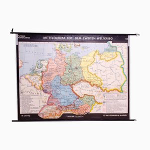
Vintage German School Map of Central Europe, 1961
Vintage Linen School Card Seals

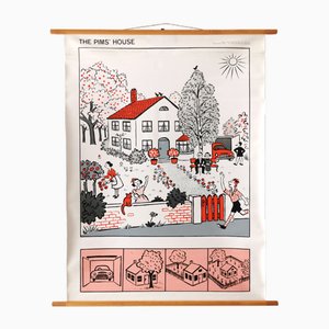
Vintage Teaching Card the Pim Family from Franz Cornelsen Verlag, 1960s
Rolls Royce Garage Advertising Metal Sign

Lotus Garage Advertising Metal Sign

Harley Davidson Garage Advertising Metal Sign

Vintage Sign in Metal, 1950s

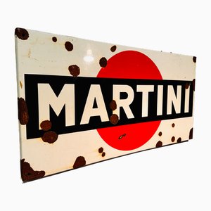
Vintage Martini Sign, 1950s
Vintage Linen School Card

Campari Soda Sign, 1960s

Vintage Store Sign, 1950s

French Toleware Violin Makers Shop Trade Sign, 1950s

Victorian Lithographic Map with Environs of Southampton, England

Double-Sided Teleselection Sign in Metal

Large Chart of Jamaica, 1753

Tourists Map of New Yorks Subway System, 1954

17th Century Prospect of Lisbon

Engraved Constellation Maps by W. Newton, Set of 5

Boston Harbor from Views of North America from Zuber Et Cie, France
Advertising Sign in Folded Sheet Metal, 1950s
Authentic Wooden Pharmacy Sign, France, 1930

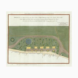
Early 19th Century Map for Houses in Hyde Park by J. Fordyce, 1809
Large-Scale Survey of London Map with Marylebone & St Pancras

Large-Scale Survey of London Map with Knightsbridge

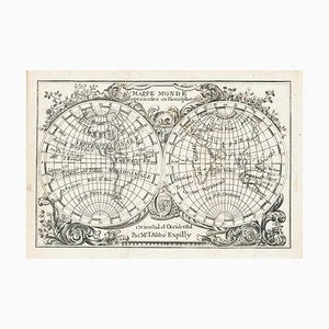
Miniature Double-Hemisphere World Map by J. Expilly, 1765
17th Century Miniature Map of Russia by Hondius, 1610

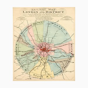
London's Railway Network, Late 19th Century
17th Century Miniature Map of Asia by N. De Fer, 1685

Early 18th Century Map of the British Isles by N. De Fer, 1705

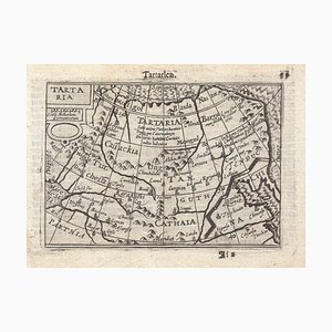
16th Century Miniature Map of Tartary by B. Langenes, 1599
16th Century Miniature Map of Ischia by B. Langenes, 1599

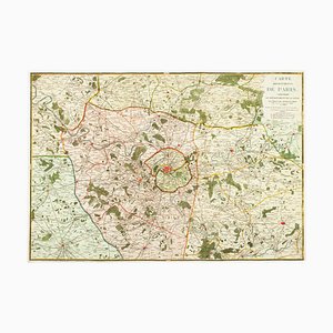
The Environs of Paris Map, Early 19th Century
Prospect of Munich, Early 18th Century

Trending